
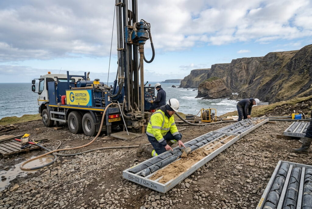
You drill, You recover several meters of hard rock. You classify it as bedrock, But what if it isn’t?
During the Quaternary period, glaciers reshaped large parts of Northern Europe, the United Kingdom, and Ireland. The legacy of glaciation has left behind complex, variable ground conditions that present significant challenges for offshore developments.
Successive glacial episodes during the Quaternary caused ice sheets to extend over northern Europe, Great Britain and Ireland. The ice sheets were in flux, repeatedly growing and receding. The colder global environment meant glaciers had frozen much of the world’s H2O, which made sea level 120–130 m lower than today. Much of today’s North Sea and Baltic Sea was dry land!
Engineering Implications
Glacial ice can exert substantial erosional and deformational forces on the underlying landscape. which gives rise to a whole host of geohazards. One particular engineering challenge brought about by glaciers is difficulty in accurately identifying “bedrock”, or rock that’s in-situ.
Transported boulders, glaciotectonics and periglacial weathering can all give misleading indications of bedrock; if engineers install a foundation into material that isn’t bedrock, it may “punch through” into weaker underlying material, experience excessive deformation or be challenging to install.
Transported Boulders
Glaciers possess significant transport energy, capable of moving boulders several metres across and over long distances. During ground investigation, a borehole intercepting a large boulder may recover several metres of competent core material, giving the false impression of bedrock. Without careful verification, engineers risk installing foundations into isolated blocks rather than continuous rock. Figure 1 shows an example of a glacially deposited boulder on land.
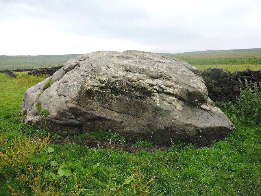
depicts 1 Example of glacially deposited boulder https://thejournalofantiquities.com/category/glacial-erratic/
Glaciotectonics
As glaciers advance, they can uproot entire rafts of weak bedrock, thrust them overland and transport them significant distances. This dramatic process can develop structural features that are usually associated with plate tectonics, such as folding, faulting and the development of imbricated fans. These features vary from the small to regional scale and can greatly reduce the ground strength or displace rafts of rock over soils giving a false impression of rockhead.
Prominent examples include:
-
Cromer, Norfolk:
Chalk rafts exposed in cliff faces, clearly detached from their original stratigraphy and overlaying soil. (see Figure 2).
-
Møns Klint, Denmark:
An advancing glacier has pushed and thrusted up the entire landscape, resulting in several imbricated slabs of chalk that are separated by till and glaciolacustrine deposits. (see Figure 3 and Figure 4).
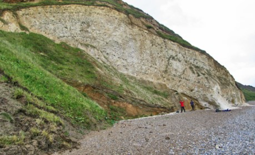
presents 2 Example of glaciotectonics at Cromer https://www.geolsoc.org.uk/science-and-policy/100-great-geosites/folding-and-faulting/cromer/
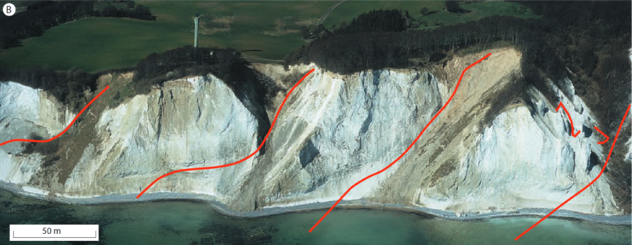
Figure 3 Example of glaciotectonics at Mons Klint https://scispace.com/pdf/thrust-fault-architecture-of-glaciotectonic-complexes-in-w43z55fd4k.pdf
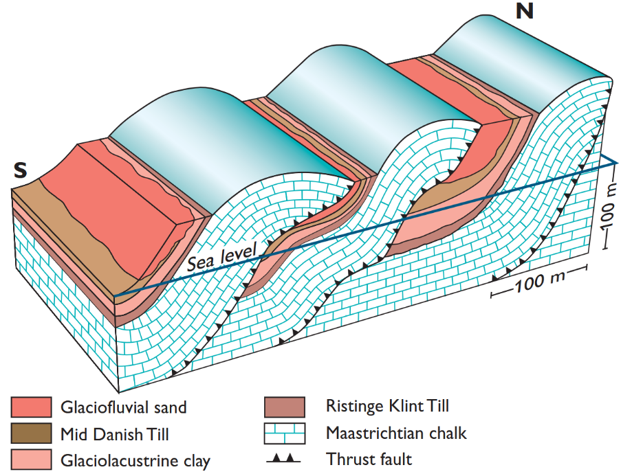
Image 4 Schematic showing glaciotectonics at Mons Klint https://www.researchgate.net/publication/242533585_Structural_development_of_Maglevandsfald_A_key_to_understanding_the_glaciotectonic_architecture_of_Mons_Klint_SE_Denmark
Periglacial Cryoturbation
The environment ahead of the ice sheet is called the “periglacial environment”, its characterized by seasonal or permanent freezing of the ground. The freezing and thawing of porous bedrock results in weathering and disaggregation termed “cryoturbation”. The temperatures are less extreme with depth resulting in the intensity of weathering decreasing.
Rather than a distinct soil/rock boundary, a gradual change occurs, complicating the classification of ground units and making it difficult to assign reliable geotechnical parameters. Figure 5 and Figure 6 show examples of cryoturbated chalk.
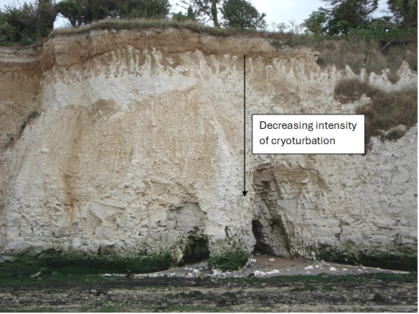
Figure 5 Example of heavy cryoturbation in chalk https://ars.els-cdn.com/content/image/1-s2.0-S0016787824000178-gr41.jpg
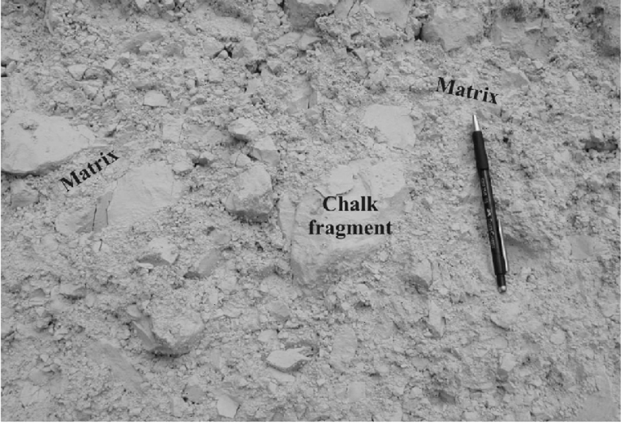
Figure 6 Example of chalk structure modification due to cryturbation https://www.researchgate.net/figure/The-diamicton-is-the-frost-altered-form-of-the-chalk-It-is-constituted-of-chalk-remnants_fig1_250085664
Best Practice to Overcoming Uncertainty in Rockhead
Accurately distinguishing between true bedrock and misleading formations requires a robust, multidisciplinary approach. A desk study should identify expected ground conditions and potential geohazards before intrusive site investigation begins. An informed view of ground conditions allows potential warning signs to be identifies, including:
- A borehole encounters rock shallower than expected or shallower than an adjacent borehole.
- Irregular or inclined soil/rock interfaces
- Bedding orientations inconsistent with regional structural geology
- The encountered rock type (lithology) being different to the surrounding area
- Structural geological feature (folding, faulting etc…) unrelated to known tectonic events being present
Confirming Bedrock Continuity
Where risk factors are present, engineers should employ confirmation techniques:
-
Geophysical Surveys
(e.g., seismic reflection) to image subsurface layering and detect soil beneath suspected rock.
-
Deep Borehole Drilling
to ensure penetration beyond potential glacial boulders or displaced rafts, verifying continuous competent bedrock.